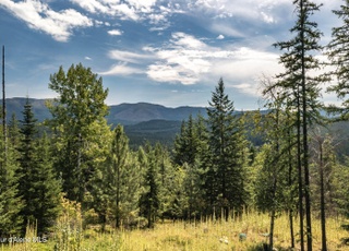
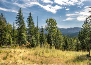
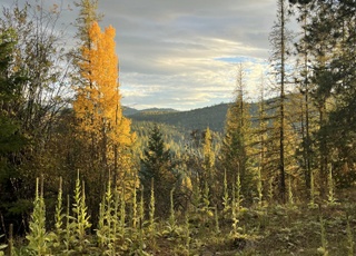
One property...two distinct building opportunities...the best of both worlds! The lower portion offers the convenience of year-round access & everyday living while the upper portion provides a completely different experience with panoramic views & exceptional privacy. A beautiful expanse of forest connects these two unique building areas, creating desirable privacy, abundant wildlife habitat & the natural beauty North Idaho is known for. A public Pack River access is within walking distance making it easy to enjoy fishing, kayaking & floating 'The Pack.' The Idaho Club--Idaho's only Jack Nicklaus Signature Golf Course--is just one mile away. Sandpoint & Ponderay are only 10 minutes away for shopping, dining & medical services, while Schweitzer Mountain Resort is approx. 15 miles 'up The Hill.' The lower portion features approx. 3 to 4 buildable acres with convenient access from county-maintained Lower Pack River Road via a newly constructed ingress/egress road. Power is available at the property line, & several active natural springs provide an excellent water source (see documents). The upper portion (accessed via Whodathunkit Road) offers approx. one buildable acre with breathtaking views of the Pack River, Pack River Flats, the surrounding mountain ranges & the valley below--an ideal setting for an off-grid cabin, private campsite, hunting retreat or simply taking in the spectacular scenery. It's rare to find a property that offers both the convenience of year-round living & the privacy of an elevated mountain retreat--all within minutes of Sandpoint.
Vacant landProperty Type
11.49 acresLot Size
$19,060Price/Acres
Listed by Joni White• Tomlinson Sotheby's International Realty (Idaho)
Steep slopes and sloped terrain with some level areas
Irregular lot shape
Wooded land
Located on a golf course
Publicly maintained road access
Scenic views
Home design
Property is a 10+ acre parcel (approx. 11.49 acres)
Utilities
Utilities available
No sewer service
Water from a spring
Sale and tax history for NNA Lower Pack River Rd
Sale History
Tax History
Date
Event
Price
CDAMLS #26-4630
Jun 25, 2026
Price Changed
$219,000
May 8, 2026
Listed
$249,000
CDAMLS #24-3908
Nov 14, 2024
Pending
—
Oct 2, 2024
Relisted
—
Oct 1, 2024
Pending
—
Sep 25, 2024
Price Changed
$70,000
Aug 29, 2024
Price Changed
$74,000
Jul 26, 2024
Price Changed
$79,000
Jun 28, 2024
Price Changed
$84,000
May 2, 2024
Listed
$89,000
SELMLS #1
Mar 16, 2024
Price Changed
$298,000
CDAMLS #23-7529
Mar 16, 2024
Price Changed
$298,000
Aug 11, 2023
Listed
$308,000
CDAMLS #23-5551
Jun 19, 2023
Listed
$179,500
SELMLS #20231301
Jun 28, 2023
Sold
—
Jun 3, 2023
Delisted
—
May 26, 2023
Listed
$175,000
CDAMLS #23-4668
Jun 3, 2023
Pending
—
May 26, 2023
Listed
$175,000
CDAMLS #22-2122
Jun 24, 2022
Relisted
—
May 20, 2022
Pending
—
Mar 28, 2022
Listed
$187,500
SELMLS #20220543
Apr 1, 2022
Listed
$175,000
SELMLS #20220479
Mar 28, 2022
Listed
$187,500
SELMLS #20212532
Mar 15, 2022
Sold
—
Aug 18, 2021
Listed
$165,000
CDAMLS #21-8610
Feb 1, 2022
Pending
—
Nov 1, 2021
Price Changed
$165,000
Sep 14, 2021
Price Changed
$195,000
Aug 18, 2021
Listed
$215,000
CDAMLS #20-5903
Aug 19, 2020
Pending
—
Jun 24, 2020
Listed
$99,000
SELMLS #20202327
Sep 18, 2020
Sold
—
Jun 24, 2020
Listed
$99,000
CDAMLS #19-7778
Feb 10, 2020
Delisted
—
Jul 12, 2019
Listed
$100,000
CDAMLS #19-3517
Feb 28, 2020
Sold
*
Jan 12, 2020
Pending
—
Jul 26, 2019
Relisted
—
Jul 9, 2019
Pending
—
Apr 17, 2019
Listed
$135,000
SELMLS #20190808
Feb 28, 2020
Sold
—
Apr 16, 2019
Listed
$135,000
SELMLS #20182278
Dec 18, 2018
Sold
—
Jun 26, 2018
Listed
$145,000
CDAMLS #18-7952
Nov 9, 2018
Pending
—
Oct 5, 2018
Price Changed
$145,000
Jul 11, 2018
Listed
$155,000
CDAMLS #09-8856
Sep 16, 2015
Delisted
—
Jul 15, 2009
Listed
$179,021
CDAMLS #14-7899
Feb 3, 2015
Delisted
—
Jul 17, 2014
Listed
$72,000
CDAMLS #13-7919
Mar 3, 2015
Delisted
—
Aug 1, 2013
Listed
$99,900
CDAMLS #09-13689
Oct 16, 2014
Delisted
—
Dec 17, 2009
Listed
$450,000
CDAMLS #08-14631
Oct 16, 2014
Delisted
—
Dec 4, 2008
Listed
$450,000
CDAMLS #08-9671
May 30, 2013
Delisted
—
CDAMLS #09-9335
Jan 8, 2010
Sold
*
Jul 27, 2009
Listed
$75,000
CDAMLS #08-11018
Mar 26, 2009
Delisted
—
Aug 18, 2008
Listed
$450,000
SELMLS #20805073
Oct 8, 2008
Listed
$159,000
SELMLS #20805052
Oct 6, 2008
Listed
$325,000
As the MLS and public records start to fill up, we'll list the details here.
Public record
Public record
Zoning
Beds
—
Baths
—
Stories
—
Lot width
—
Lot depth
—
Lot size
—
Year renovated
—
Finished Sq. Ft.
—
Unfinished Sq. Ft.
—
Total Sq. Ft.
—
Year built
—
Style
Vacant Land
County
Bonner County
APN
RP58N01W368550A
Parking Spaces
—
Basement
—
Accessible
—
HOA Dues
—
Garage
—
Features
—
Last updated by owner on Jun 21, 2026.
A/F-20
Agricultural/Forestry District
The agricultural/forestry district is established to provide for agricultural and forestry pursuits, including livestock production, forestry, horticulture, floriculture, viticulture, and necessary accessory uses for treating, storing and processing agricultural products. The purpose of the A/F district is to preserve, protect and maintain areas that are rural in character and the integrity of the forest/woodland areas where viable agricultural pursuits can be feasible and to avoid fragmentation of forests and farms. These purposes are accomplished by: Establishing residential density limits and conservation development standards to retain areas sized for efficient farming; Allowing for uses related to agricultural production and limiting nonagricultural uses to those compatible with agriculture, or requiring close proximity for the support of agriculture; Use of this zone is appropriate in areas designated by the comprehensive plan as follows: A/F-20 in all areas designated as prime ag/forest land in the comprehensive plan. The A/F-20 zone is also appropriate in areas designated ag/forest land in the comprehensive plan that also feature: Prime agricultural soils. reas where one or more of the following apply: limited services; characterized by slopes steeper than 20 Percent; where access may be absent or limited to substandard road systems or where large tracts of land may be devoted to ag/forest production; Are characterized by agricultural or forestry uses.
Permitted uses
Include but are not limited to:
Agriculture
Housing-Single unit
Housing-Multiple units
Park & open space
Climate risks
1/10 Flood Factor
Minimal risk of a flood reaching the building in the next 30 years
3/10 Fire Factor
0.62% chance of being in a wildfire in next 30 years
2/10 Heat Factor
5 days above 91° expected this year, 10 days in 30 years
1/10 Wind Factor
Minimal risk of severe winds over next 30 years
9/10 Air Factor
18 unhealthy days expected this year, 19 days in 30 years
Provided by First Street
Historical weather
Sandpoint, ID • 83864
Average low and high temperatures (°F)
34
26
38
26
49
33
58
35
69
44
75
49
84
54
84
55
77
49
56
37
43
34
38
31
Jan
Feb
Mar
Apr
May
Jun
Jul
Aug
Sep
Oct
Nov
Dec
Sun exposure
80/ 100
Very good sunlight
Sunscore
There appears to be minimal shading by surrounding buildings, terrain, and vegetation.
9.1 hrs
4.7 hrs
JuneDecember
Provided by Shadowmap
Redfin Estimate for NNA Lower Pack River Rd
$206,488
$13K under list price of $219K
Nearby comparable homes
The Redfin Estimate uses 6 recent nearby sales, priced between $179K to $495K.