Online listing photos often shape a buyer’s first impression of a home. They want to understand the home’s setting, the size of the lot, and what makes the property unique before deciding whether it’s worth a visit. That’s one reason real estate drone photography has become a popular addition to many listings.
That said, aerial photography isn’t a must-have for every home. Whether you’re selling a home in Houston, TX or listing a rental in Asheville, NC, knowing when to use this style of professional photography can help highlight the features that matter most to buyers.
Here are seven situations where real estate drone photography can make a listing more compelling.
Key takeaways:
- Best for homes where the setting is part of the selling point.
- Shows lot size, layout, and nearby amenities at a glance.
- Helps buyers visualize features that aren’t visible from the ground.
- Less valuable for standard homes on small lots.
- Should be performed by a licensed drone operator following local regulations.
1. The property sits on a large lot or acreage
Large properties are difficult to capture from the ground. Aerial photos show the property’s full footprint and help buyers appreciate how much land they’re getting.
Bradley Harkey, owner at LuxRE Photos, says drone photography is especially valuable for homes with room to grow. “Drone photography can really be essential when you are selling a home with a lot of land. A view from above can showcase the potential even when it’s not exactly obvious from the ground.”
He says buyers often struggle to picture what an undeveloped yard could become. “Oftentimes an unprepped backyard can just look like a bunch of weeds to a potential buyer, but when seen from above, you can visualize where that pool can go, or that basketball hoop, or that go-kart track you always wanted as a kid. Some homes have so much potential, but it’s hard to see between the weeds.”
Whether it’s acreage, an equestrian property, or simply a spacious backyard, aerial images help buyers see the property’s potential.
2. The home has waterfront views or scenic surroundings
Some of a home’s best features aren’t visible from the front yard. Waterfront access, mountain views, wooded privacy, and distinctive architecture all benefit from an elevated perspective.
Doug Smith, principal and founder of Houzpics LLC, explains, “Aerial photography is especially valuable for waterfront or estates with large, feature-rich lots, multi-story architecture, and homes with scenic surroundings. Aerial images help buyers understand the property’s layout and highlight features that traditional ground-level photos may not fully capture.”
Rather than focusing only on the home, aerial photography showcases the entire setting.
3. Nearby amenities could help sell the home
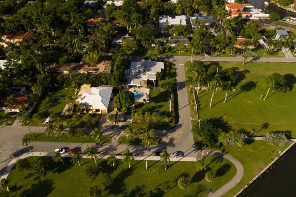
Sometimes the neighborhood is just as important as the house. Homes near golf courses, parks, beaches, clubhouses, or walking trails can benefit from aerial photography because buyers immediately see what makes the location desirable.
Greg Hendry, owner of William & Fields Media, says, “Drone photography delivers the most value for listings with distinctive lot sizes, acreage, waterfront property, or if the home is on a golf course. Aerial shots help buyers understand the proximity to neighborhood amenities like pools, clubhouses, tennis courts, and parks, while also giving a clearer sense of the property’s layout and how it fits into the surrounding area.”
Instead of relying on maps, sellers can show buyers exactly what they’re getting.
4. Outdoor features can be highlighted
When the backyard is a major selling point, buyers should be able to see the full picture. Large pools, outdoor kitchens, guest houses, sports courts, private docks, and landscaped yards often have more impact from above.
According to Annie Ives, CEO at The MLS, “Drone photography is most beneficial for properties with features that are difficult to appreciate from ground level, such as large lots, expansive backyards, pools, waterfront locations, scenic views, or unique landscaping.”
She says aerial images also provide valuable context. “It highlights a home’s relationship to its surroundings, including nearby parks, golf courses, beaches, or desirable neighborhoods. Aerial images help buyers better understand the property’s layout, scale, and setting, making listings more engaging and memorable.”
5. The lot or architecture is difficult to photograph
Some homes simply don’t photograph well from the ground. Hillside homes, steep lots, and dramatic rooflines often look distorted at eye level, while drones can capture them from more flattering angles.
According to Derek Smith, owner at Come and Shoot It Photography in Austin, TX,”Drone photography earns its keep on property listings where the land or setting is part of the story such as large acreage, waterfronts, country views, or homes with distinct architecture.”
He also points to a technical advantage. “It’s a fix for homes on sloped or hilly lots: a ground-level camera has to point up at the house, which distorts the vertical lines, but a drone can rise to match the roofline and shoot it straight-on.” Drone images can help buyers understand the general layout of a rural property, although photographs should not be used to determine its legal boundaries.
6. Buyers need more context before scheduling a showing
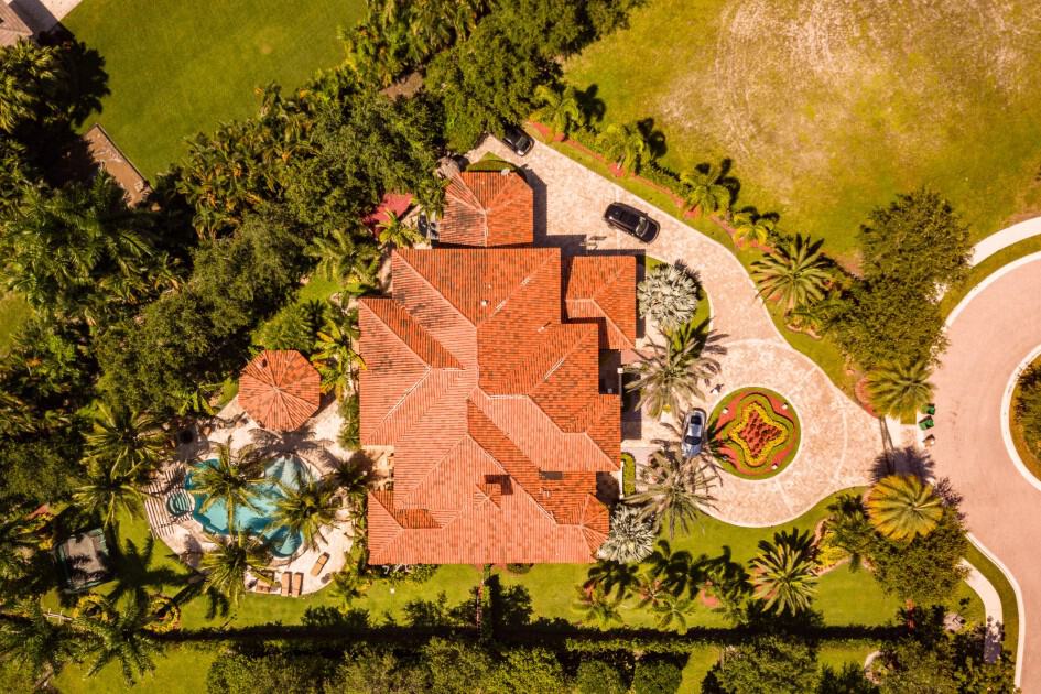
Many buyers decide whether to tour a home within seconds of viewing an online listing. Giving them additional context can make that decision easier.
David Hughes, executive director at Front Door Media, says aerial photography has become a standard marketing tool for many properties. “Drone photography has become an almost necessary add-on to regular photography when it comes to marketing properties,”
He explains that it’s especially valuable for showcasing both the property and its location. “For homes on large lots or acreage, there is no other way to accurately capture the scale of the property. For other properties that are in prime locations near things like parks, schools, shops, restaurants, etc., showing the proximity from above is a valuable marketing tool.”
Even a few well-composed aerial images can give buyers the context they need before deciding to schedule a tour.
7. The land is part of the property’s story
Some properties are defined as much by their setting as the home itself. Tex Kelly Productions says that’s when drone photography provides the greatest value. “Drone photography earns its keep on properties where the land is part of the story – acreage, big lots, or anything backing up to open space, water, or views.”
Aerial photos also answer questions traditional listing photos can’t. “From the ground, buyers can’t tell how a home actually sits on its lot or what surrounds it, and one good aerial answers that in a single frame.”
That doesn’t mean every listing needs a drone. “For a standard home on a small city lot, skip it – but the moment the setting is a selling point, aerials are worth every penny.”
Regulatory concerns and potential drawbacks
Drone photography isn’t the best fit for every listing. Before scheduling one, consider the following:
- Hire a qualified professional. Work with an FAA-certificated remote pilot who operates in accordance with Part 107 and understands any additional requirements that may apply in your area. An experienced operator should also take steps to respect people’s privacy, avoid unnecessary footage of neighboring properties, and use caution when showing property lines or boundaries.
- Consider the return on investment. Drone photography is often most valuable when the land, views, or outdoor spaces help sell the home. For many homes on smaller lots, professional ground-level photography may be enough.